What are the applications for spatial data?
Several terabytes: this is the phenomenal amount of data produced by the Sentinel satellites each day! How can these data flows be used to develop concrete applications to be used by those who manage territories? This is what spatial application experts focused on at the AppSpace Forum, an event organized by the CNES, GIS BreTel, Booster Morespace and Institut InSpace from October 17 to 19, 2017.
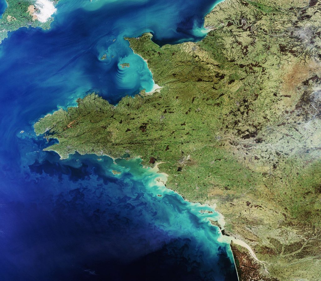
Copernicus, a program run by the European Space Agency and the European Union, has launched the Sentinel satellites – 1A, 1B, 2A, 2B and 3A, each equipped with different sensors for taking a variety of measurements. The goal is to provide European users, and more specifically researchers, with comprehensive, free observational data of the entire Earth: oceans, land, vegetation, coastal areas, radiometry, temperature, altimetry, etc. But can spatial data be used to develop concrete applications?
The question of an application for data from the Copernicus program was at the forefront of the AppSpace event, co-organized by GIS Bretel. For the first time, this initiative brought together all actors in the region of Brittany, but also spatial application professionals from throughout France and Europe, to participate in round table discussions, themed workshops, and an exhibition space for companies and laboratories. The organizers of Appspace intend it to become a reference event taken up by other regions of France and Europe. The goal is to obtain a clear, overall vision of the regional, national, and even European ecosystem of spatial apps.
Encourage end users to take possession of data
“The takeaway from this event is that, generally speaking, the world of research is quite good at taking possession of spatial data”, explains Nicolas Bellec, operational director of GIS BreTel. “However, some field specialists, such as biologists or ecologists, sometimes have difficulty using these data in their research, and call on other labs specialized in the field of space.”
Beyond the world of research, data from the Copernicus program were especially designed to help territorial authorities and regional and State services, to meet their own needs. But these actors, considered as the end users, do not use these data. “But the resolutions of the new satellite sensors are increasingly well-adapted to their needs!” states Nicolas Bellec. “The scope of applications is also very broad: maritime safety and security, land use and regional planning, monitoring of vegetation and biodiversity, adaptation to climate change, etc. At the Appspace forum, we tried to understand why.”
By bringing together the worlds of research, companies and end users, the Appspace event highlighted the barriers to using spatial data and finding appropriate solutions. “What we found was that territorial managers lack training and information on these subjects. Researchers, companies and users want to create applications together, to better meet the needs of territorial managers” Nicolas Bellec explains.
The other difficulty is that spatial data can rarely be the sole solution to a concrete problem. They often must be used with other data, and in particular, field data, to find their place in applications. There are several ongoing projects which manage to incorporate spatial data into existing processes of information acquisition in the territories.
The Sésame project, created by Lab-STICC*, the teams Obelix and Myriads from IRISA and funded by the DGA and the ANR, crosses spatial data with AIS data from ships to develop applications for monitoring and surveillance of maritime traffic.
Develop technologies capable of handling data flows
The goal of the Sésame project is to develop technologies capable of detecting and giving real time documentation of unusual behavior of ships: illegal entries into defined areas, suspicious deviations from trajectories, illegal fishing, etc. To achieve such a result, high resolution photographs of the water’s surface produced by Sentinel satellites need to be crossed with AIS (Automatic Identification System) data emitted by ships. Each ship emits an AIS signal, which includes information on the ship itself, its route and position, at resolutions per minute. The challenge of the project is to process these extremely high flows of data. On top of the terabytes of data from the Sentinel satellite, tens of millions of AIS messages are produced each day.
“CLS, our industrial partner, is a solutions operator for monitoring maritime traffic using satellite data. The current data processing chains will need to be reviewed in order to cope with the scale of the flows which are currently being produced” explains Ronan Fablet, professor and researcher in the Lab-STICC laboratory at IMT Atlantique and coordinator of the Sesame project. “The company is embarking on research and development processes to use Big Data and Machine Learning technology in monitoring maritime activity. The Sésame project is an integral part of this process.” With a consortium of teams specialized in Big Data, Machine Learning and remote detection, the goal of Sésame is to manage data flows with the development of suitable material and software infrastructure, and to develop machine learning techniques for detecting ships and unusual behavior in satellite images.
These technological developments are intended to be used first of all by CLS, then made available to operators such as the ESMA, the institution in charge of surveillance of European maritime areas. “Overall, the end users targeted by the project are the institutions in charge of maritime surveillance for regions, states, or groups of states” specifies Ronan Fablet.
Finally, as well as offering solutions to concrete issues of maritime traffic surveillance, the technologies developed by the Sésame project will pave the way for the use of already existing databases, by associating them with other types of satellite imagery. With the development of adapted infrastructure and Big Data technology, the gigantic data flows produced by Sentinel satellites will also be channeled, processed and interpreted, to serve the development of many other applications designed for end users.
* Members of Lab-STICC: IMT Atlantique, UBO, UBS, CNRS, ENIB and ENSTA Bretagne
Also read on I’MTech:
[one_half]
[/one_half][one_half_last]
[/one_half_last]


Leave a Reply
Want to join the discussion?Feel free to contribute!