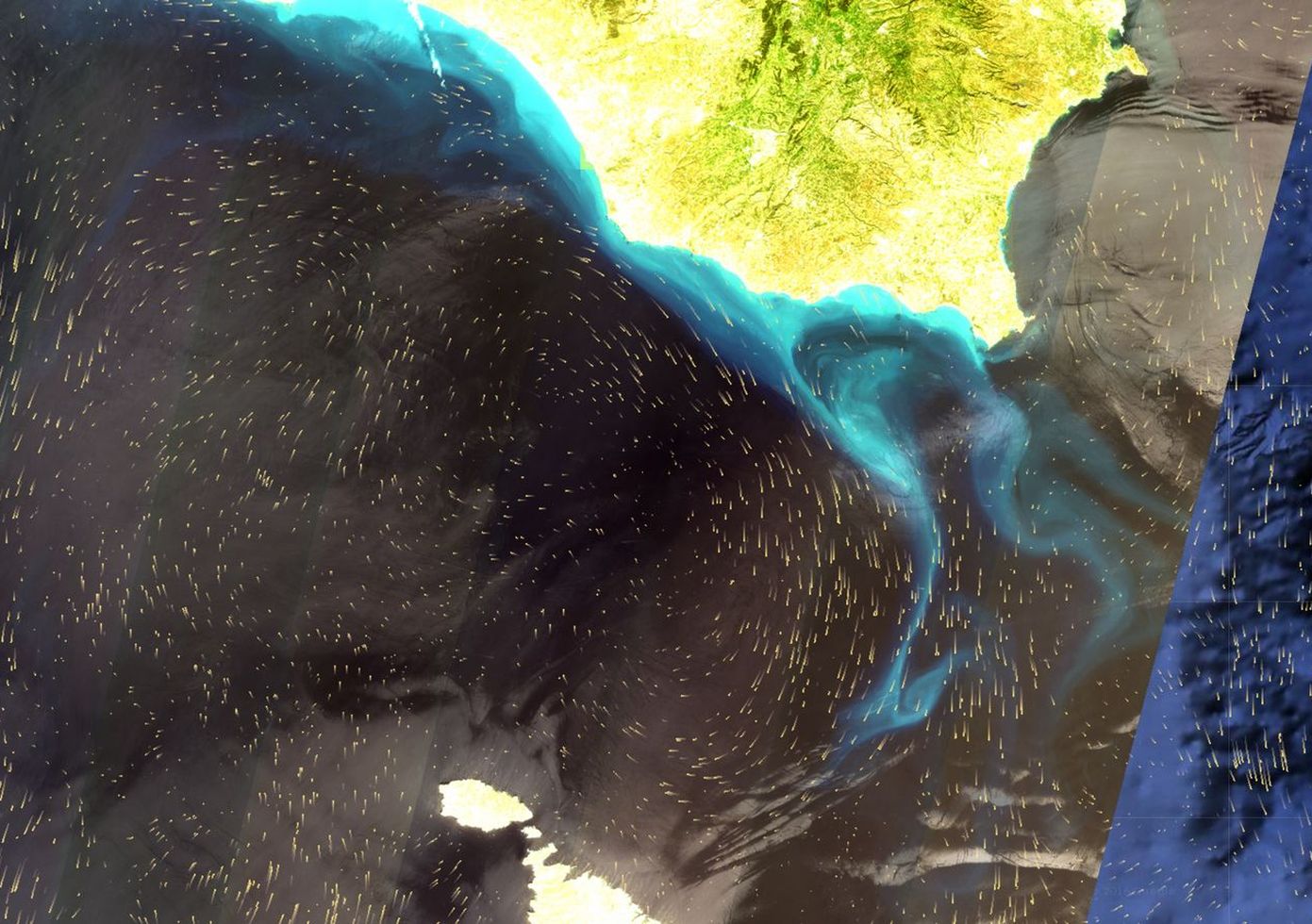
eOdyn: technological breakthrough in the observation of ocean surface currents
Existing methods for measuring ocean surface currents are expensive, difficult to implement and limited in the amount of information they can gather. The solution proposed by the eOdyn startup, based on the algorithmic analysis of data from maritime traffic, represents a real technological breakthrough. It is very affordable and more effective, enabling the real-time and delayed observation of marine currents across the entire surface of the globe. Using this technology, eOdyn is developing many different services for the those involved in maritime transport, from the offshore oil industry, to sea rescue and research on climate change. Incubated at IMT Atlantique, the startup’s customers and partners include CMA CGM, Airbus Defence and Space, the European Space Agency and IFREMER.
Two main solutions are used to measure marine currents on the high seas. The first is to throw drifting buoys into the sea equipped with GPS and track their travel. This historical technique is still just as effective, yet it is costly and difficult to implement. It requires the buoys to be spread throughout the ocean in a homogeneous manner, and the batteries of the drifting sensors must be regularly changed. The second method is to measure the ocean currents using the six altimetry satellites that are currently in orbit. At best, when the six satellites are located above the ocean, and not above the continents, they can obtain six measurements of the water’s surface at a given time that can be used to deduce the presence and direction of the currents. This technique also requires considerable financial means, as evidenced by the €1.2 billion price tag on the next project involving the development, launch and three-year operation of the new-generation altimetric satellite known as SWOT.
The eOdyn startup now proposes a simple and inexpensive solution for the digital analysis of open data, including AIS data (Automatic Identification System), to measure the currents in real time and delayed time. This data allows ships to be operated as sensors collecting information on the currents. Considering that approximately 100,000 are sailing around the globe simultaneously, this represents 100,000 measurement points, as compared to the six points currently provided by satellites.
A simple, affordable and complete solution for observing marine currents
Each ship emits an AIS message every ten seconds. This message contains information on the vessel itself, its position and its path. All data is collected by an international network of receivers and antennas installed along the coastlines or on satellites in low Earth orbit. These AIS messages were initially designed and used as a maritime security system for preventing collisions. “It was necessary to create an open system that allows for exchanges of unencrypted information between vessels, so that they can see each other,” says Yann Guichoux, the startup’s founder.
eOdyn collects and analyzes these AIS data and submits them to an algorithm capable of analyzing each vessel’s path in different navigation conditions and produce a model of hydrodynamic behavior. Based on the vessel’s movement in relation to its planned path, it deduces the direction and intensity of the current it is affected by. “The algorithm needs a significant amount of data to function,” explains Yann Guichoux. “This is where the concepts of big data and machine learning come into play. For the algorithm, there is a learning phase for each vessel that is analyzed.”
Read more on I’MTech: What is big data?
In addition to being inexpensive, the solution proposed by eOdyn offers more comprehensive data than the altimetry satellites: “Altimetry measurement is limited, because it only obtains information on the current that is perpendicular to the satellite track” Yann Guichoux explains. “The information provided only pertains to a geostrophic current, a theoretical current. The actual current includes this geostrophic current, but also includes the tidal current and the current affected by the wind speed, which eOdyn replicates.”
Fuel economy, sea rescue and climate research
“At first, our business model was to sell the data we obtained. Now, we are progressively moving towards providing value-added services to various sectors,” Yann Guichoux explains. In the field of maritime transport, rather than selling the data directly to companies that do not know how to process and use them, the startup will propose optimal navigation routes that will allow ships to take advantage of driving currents and save on fuel. Furthermore, a monitoring system is being developed for offshore oil companies. It will alert the companies in real time of the presence of whirlpools that could potentially disrupt the drilling operations, cause material damage and the release pollutants into the ocean. Yann Guichoux also plans to develop a drift prediction tool for sea rescue, which will provide an estimation of the location of a person who has drifted out to sea in order to help guide search and rescue operations. Finally, the startup is also interested in providing data for research on climate change, for example to ascertain the slowdown of the Gulf Stream current.
But eOdyn won’t stop there! Using the same algorithmic basis, modified with significant variations, the startup is working on new projects for measuring swells and wind, which will come out in 2018. “A ship is a moving object in the water, subject to the constraints of the currents, swells and waves. When we look at the data and its analysis, we gain an overview of these three parameters,” Yann Guichoux explains. With the development of new tools based on the observation of these phenomena comes the promise of new fields of application waiting to be discovered.


Leave a Reply
Want to join the discussion?Feel free to contribute!